|
In 1933, near the time that Register pilots and airplanes were landing here, Lunken Airfield looked like the photograph below. It was the major air hub serving the Queen City, Cincinnati, OH.
It was located five miles east of the heart of Cincinnati on 400 acres. It was an L-shaped, sod-surfaced field, at an altitude of 490 feet above sea level. According to the Airport Directory reference in the left sidebar, it had four concrete runways of 3,200, 3,500, 2,700 and 700 feet. Each was 100 feet wide. I see clearly three runways in this photograph. Perhaps the faint line running diagonally just left of center is the short runway.
Lunken Field, Municipal Airport, Cincinnati, OH, 1933
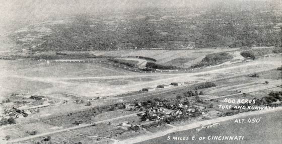 |
Regardless, the Lunken Airfield had "painted boundary cones", which are plainly visible in the image to the east of the airfield. The Ohio River, visible in the right foregound of this photo, is to the south. The Little Miami River snakes and bisects the photo across the center.
A two-way Department of Commerce radio was on the field; identifier WWAS, 272 kcs. A telephone was on the field, number E-4132, and there was a "Grade A" weather station on the field. There was a restaurant on the field and hotels in town, with the cab rate being 75 cents. Street cars also ran every five minutes. Fuel, oil and storage were available, as well as licensed repair facilities. There was no landing fee and no flood light fee.
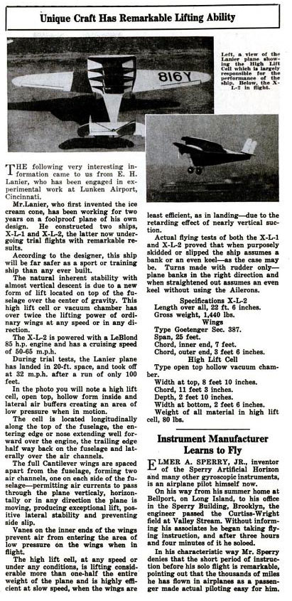
The Embry-Riddle company was resident for a while. A curious aircraft, the Lanier, was developed, constructed and flown there also. Below, from the January, 1931 issue of Popular Aviation (PA), is a brief article that describes the Lanier. For more detail on the theory and practice of the Lanier, the link provides a PDF (2.5Mb) with data.
Lanier Aircraft, Popular Aviation, January, 1931 (Source: PA)
 |
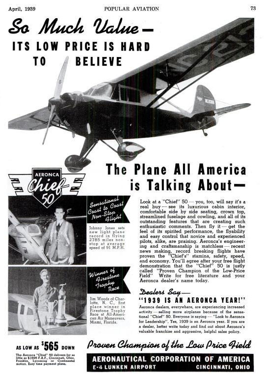
The Aeronautical Corporation of America was based at the field, manufacturer of Aeronca aircraft. Below, from Popular Aviation magazine, April, 1939, is an advertisment for their most current model.
Aeronca Advertisement, Popular Aviation, April, 1939 (Source: PA)
 |
Flamingo aircraft were also built at Lunken Field. The Vermilya-Huffman Flying Service and the Queen City Flying Service were residents, offering a flight school, aircraft sales and service, local and long distance flights, photography, aerial advertising and "circus work". The airfield was also a U.S. Army Reserve Depot and American Airways (and later American Airlines) was based there.
Below, a contemporary Google Earth image of the airfield adjusted for a view from about the same position as in the 1933 photo. Note the Ohio River at lower right. Today, the airport has three primary runways. Contemporary runway 21L-32R parallels the Little Miami River this side of the levee. If you compare the two images "then" and "now", you can see the remains of the big bend in the Little Miami outlined in grass at field center. What used to be the major east/west runway is now taxiway "C". The airport also has its own Web page.
Lunken Field, Municipal Airport, Cincinnati, OH, 2009
(Source: Google Earth)
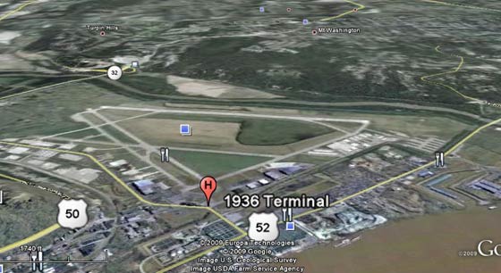 |
The terminal (facade shown below) on Wilmer Avenue is visible just to the left of the H flag, above. The terminal was built in 1936. The Little Miami still bisects this scene and flows to the east. It was rerouted farther to the east and is now separated from the airfield by a levee constructed around the airport's circumference to preclude the periodic flooding common in the area: The airfield didn't earn its nickname "Sunken Lunken" for nothing.
Lunken Airport Terminal Facade (Source: Sky Galley Restaurant)
 |
Today, Cincinnati Lunken (LUK) is still an operating airfield, although no commercial transport operators or passengers use the old terminal. Several local corporations base their aircraft there, including the great international consumer products company, Procter & Gamble. There is a thriving commercial infrastructure of fixed base operators, maintenance facilities and avionics repair shops. The office of the Cincinnati Aviation Heritage Society & Museum is located there.
Aeronca and Flamingo are long-gone, and Embry-Riddle has moved away to campuses in Arizona, Florida and, more recently, on the World Wide Web. The major passenger hub is now the Cincinnati-Northern Kentucky International Airport (CVG), about ten miles south of Cincinnati across the state line in Kentucky.
The Lunken terminal remains in its Art Deco glory (above, left), with WPA murals in the spacious foyer, and a real Aeronca C-2 suspended from the ceiling. A hint of these murals and the Aeronca can be found on page 82 of the Henegar article cited in the left sidebar.
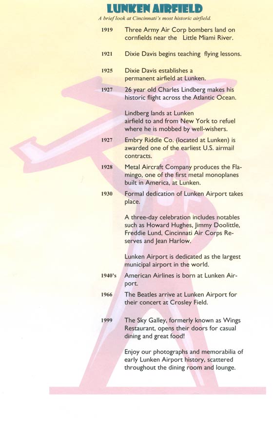
Below, a brief historical sketch of Lunken Airfield. This single sheet is available today as a handout at the Sky Galley Restaurant located in the terminal. A pleasant way to spend a lunch hour is to get a table next to the large windows overlooking the field and watch aircraft come and go while you eat.
Lunken History, 2007
(Source: Sky Galley Restaurant)
 |
At least one Register pilot met his end at Lunken Airport in 1931. Please direct your browser to Marvin T. O'Dell over on the Parks Airport Web site.
---o0o---
THIS PAGE UPLOADED: December, 2009 REVISED: 12/12/10, 06/21/14, 07/03/14, 02/26/16
|