Yuma, AZ, Fly Field, Ca. 1931 (Source: Webmaster)
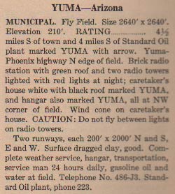 |
Yuma, AZ was a popular stopping place for pilots coming to or leaving Tucson (right sidebar). At left, from this REFERENCE, page 89, is a description of the Yuma facility in 1931. The caution not to fly between the lights on the two radio towers is well-given. Radio towers are routinely supported by cables angled to the ground. These cables are difficult to see from the air.
Below, from this REFERENCE, page 10, is an aerial image of Yuma's Fly Field Municipal Airport ca. 1933. This reference has the airfield elevation measured as 200'. It also notes the addition of the U.S. Armyi radio station WUQ, 200 kcs. Weather reports were also available (via telephone or Army radio?) in 1933.
There were no landing fees in 1933, and "modern hotels and restaurants" were avialable in the city of Yuma, accessible from the airfield by bus. Pilot services, fuel, oil, water were available during the day only, a change from the 1931 and 1937 (below) specifications.
Yuma, AZ, Fly Field, Ca. 1933 (Source: Webmaster)
 |
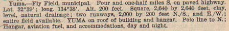
Below, from this REFERENCE, page 9, is a description of the Yuma facility ca. 1937. The runways have each gained 640 feet since the 1931 description, and the verbiage has been abbreviated.
Yuma, AZ, Fly Field, Ca. 1937 (Source: Webmaster)
 |
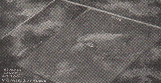
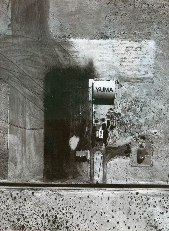
Below, another, closer view of the airfield at Yuma, AZ. The exact date is unknown. The "caretaker's house" and hangar referenced in the 1931 description, above, are both marked "YUMA."
Yuma, AZ Date Unknown
 |
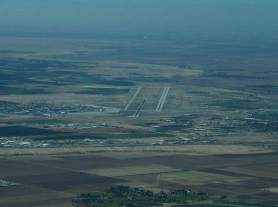
Below, Yuma looking south in 2002.
Yuma Airport, Looking Southwest, 2002 (Source: Webmaster)
 |
---o0o---
UPLOADED: 12/15/10 REVISED:
|