|
 |
||||
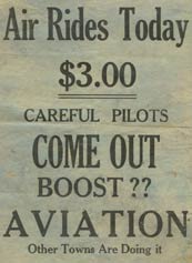
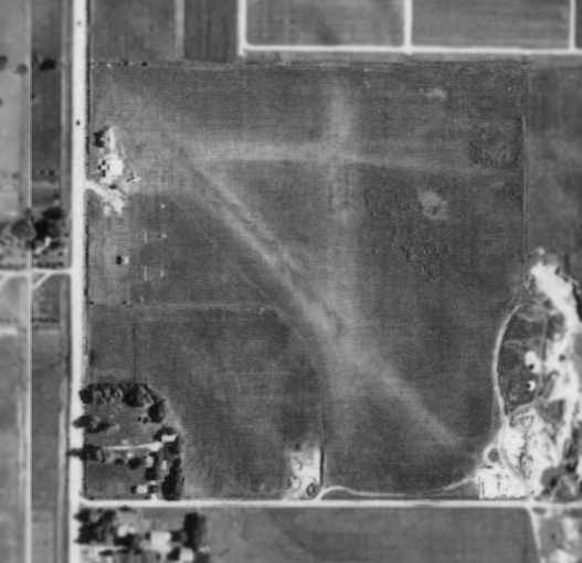
GERBRACHT FIELDAMES, IOWA
|
||||
|

| CREDITS | ||||||
|
Our thanks to Alan Spohnheimer of the Ames Historical Society for sharing photos and information about the locations of the Gerbracht fields. ---o0o--- |
||||||
|
Winners' Viewpoints: The Great 1927 Trans-Pacific Dole Race is available at the link. What was it like to fly from Oakland to Honolulu in a single-engine plane during August 1927? Was the 25,000 dollar prize worth it? Did the resulting fame balance the risk? For the first time ever, this book presents the pilot and navigator's stories written by them within days of their record-setting adventure. Pilot Art Goebel and navigator William V. Davis, Jr. take us with them on the Woolaroc, their orange and blue Travel Air monoplane (NX869) as they enter the hazardous world of Golden Age trans-oceanic air racing. ---o0o--- Clover Field: The First Century of Aviation in the Golden State. With the 100th anniversary in 2017 of the use of Clover Field as a place to land aircraft in Santa Monica, this book celebrates that use by exploring some of the people and aircraft that made the airport great. ---o0o---
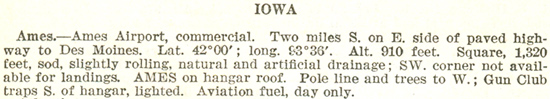
U.S. Department of Commerce. Bureau of Air Commerce. 1937. Descriptions of Airports and Landing Fields in the United States. U.S. Government Printing Office. 222 pp. This book is shared with us by Tim Kalina. |
Contact Us | Credits | Copyright © 2008 Delta Mike Airfield, Inc. This website is best enjoyed in a 1024 x 768 screen resolution. Web design by The Web Professional, Inc |
|