|
Lockport is at the far western end of New York State. The single pilot who called it home, field namesake Allan Van De Mark, wrote "Lee-Van DeMark" in the home base field of the Register. When he landed at Tucson in February, 1931, he was flying Lockheed Vega NC858E, carrying three passengers. Please direct your browser to the airplane's link for details.
Below, from the U.S. Department of Commerce book cited in the right sidebar, is a description of the airport in 1937.
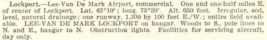
Lockport, NY Airport Information , 1937
 |
It was a challenge to locate this airfield. Google Earth gives the latitude and longitude of Lockport city center as 43°10' 11"N 78°41' 28", altitude 633 feet. The reference above sites altitude at 650 feet, at coordinates 43 degrees N 73.39W. The latitude suggested above, at 1.5 miles east of city center, is today about the corner of Pound and South Streets. That area is covered with residential housing. The 73°39' longitude given in the 1937 directory places the point more in the Saratoga, NY vicinity, all the way across in the eastern part of the state. A mistake of grave magnitude for a pilot trying to locate this airport by geographical coordinates alone (difficult before GPS)!
---o0o---
Below, shared with us by site visitor Diane Cameron via the Niagara County Historical Society in Lockport, NY, is an engineering drawing of the airport site. Named the "Lee Airport," this drawing was made February 6, 1941. It is instructive to compare it with the text description from 1937, above, and with the charted information in the 1948 topographic map just below.
Engineering Drawing, Lee Airport, February 6, 1941 (Source: Cameron)
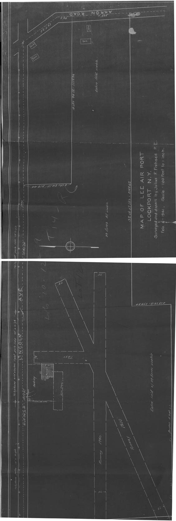 |
I've displayed this drawing vertically with north to the left so that details can be seen. Notice the hangar, parking lot and fenced areas. Note that the 1937 description identifies a single runway 1,300 feet long. The drawing, made only four years later, identifies two runways of 1,740 and 1,800 feet. The topographic map from 1948 illustrates with dashed lines a third runway running north and south that was probably a sod surface.
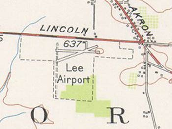
The drawing above shows the airport boundary running east all the way to Akron Road. The topographic map below suggests that the eastern boundary was truncated somewhat short of Akron. Likewise, the 1937 data cites the airfield elevation as 650 feet; the topographic map defines it as 637 feet.
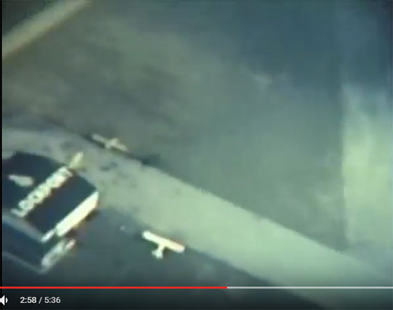
A 1947 home movie posted on YouTube shows the Lockport Airport main building from the air, below (still frame from the movie). Thanks to a site visitor for pointing out his grandfather's movies online.
Lockport Airport, 1947 (Source: Site Visitor)
 |
---o0o---
Now, site visitor Rob Flynn clears things up. Below, a 1948 topographic map of the Lockport, NY area. I have circled the location of what is called the Lee Airport. It is southeast, not east, of the center of town, unless the center of town has migrated a couple of miles northeast over the last 80 years, or the location of the airport was changed.
Lockport, NY Area, 1948
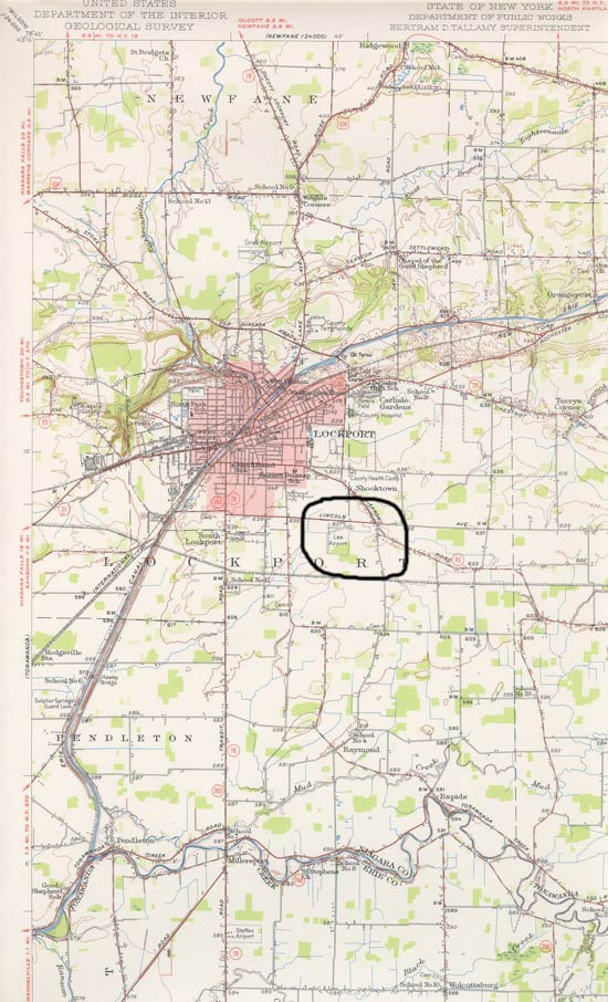 |
Below, an enlarged section of the map circled above. Note the intersection of Lincoln with Akron.
Location of Lee Airport, Lockport, NY, 1948
 |
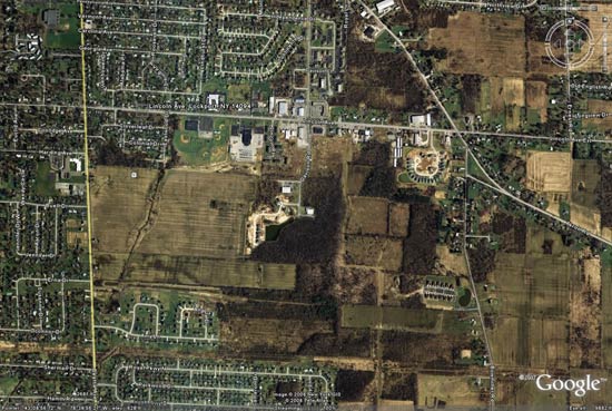
Below, an image from Google Earth of the area around the intersection of Lincoln with Akron.
Google Earth Map of the Intersection of Lincoln With Akron, Lockport, NY
 |
Now, below, I superimpose the 1948 topographic map onto the Google Earth image. I used the intersection of Lincoln and Akron for approximate sizing and alignment in PhotoShop.
1948 Map Supermposed on Google Earth Image
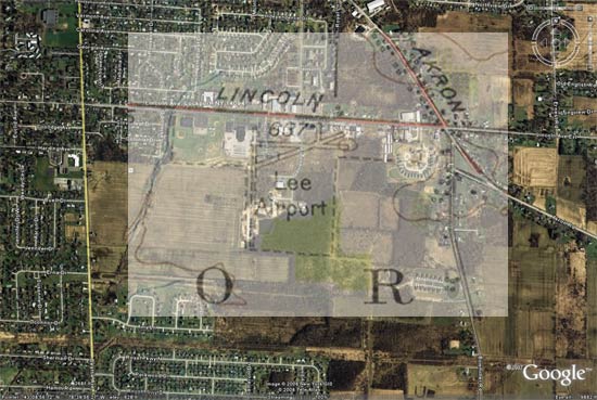 |
As you study these images, I believe you will find, as I did, almost nothing remains of the original airport runways. A good imagination might argue that the southernmost tip of what appears to be the long N-S sod (dashed) runway remains just to the west of the body of water under the word "Air...", but that would be a guess. The good news is that the southeast corner of the old airport property is still forested.
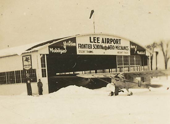
Further, Mr. Flynn provides the following image of the airport when it was open. He does not know the date, but states, "My Grandfather and his brother were very very good friends with Bob Lee, the owner, and co-owned aircraft with my grandfather his brother and a few other people. I also just acquired a photo of the airport [below] but do not know the exact year it was taken. Also it was listed that the airport was abandoned in 1988...."
Lee-VanDeMark Airport, Lockport, NY, Date Unknown
 |
---o0o---
THIS PAGE UPLOADED: 10/26/08 REVISED: 12/02/08, 01/10/17. 12/19/22
|