|
Rochester Airport at the time of our Registers was a major north-central New York air transport destination. It remains so at the upload date of this page as the Rochester International Airport. Although the contemporary airport is co-located at the same latitude and longitude as the old airport, things have changed.
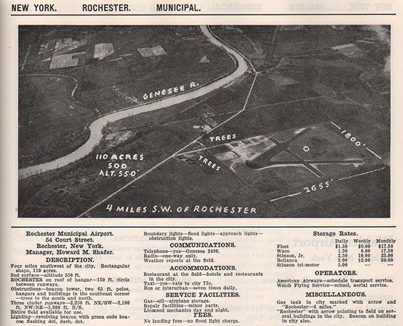
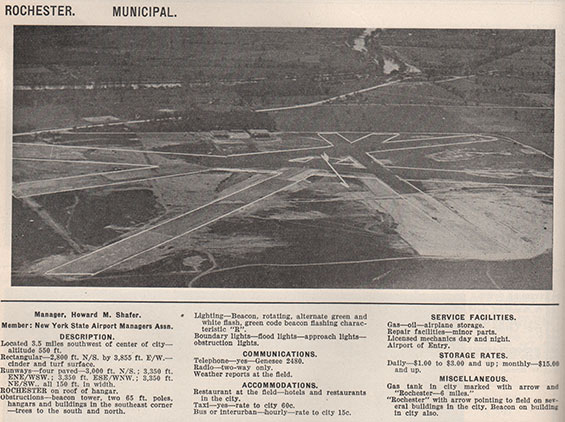
Below, from this 1933 REFERENCE, is a view and description of the Rochester Municipal Airport. It had three cinder runways. American Airways is cited as a business resident.
Rochester Municipal Airport, 1933 (Source: Webmaster)
 |
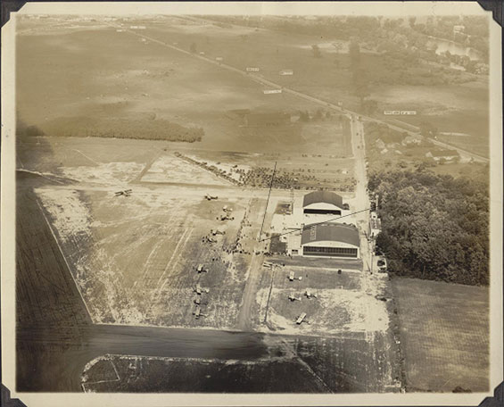
Located 4 miles southwest of the City of Rochester, it had several buildings on the field. One of them had "ROCHESTER" painted on the roof. You can see that on the aerial photograph just below, circa 1934.
Rochester, NY Airport, Ca. 1934 (Source: Russell)
 |
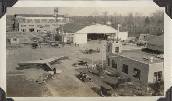
Note the two lines I drew at about the middle of this photograph. They represent the approximate angle of view of the next photograph, below. You can just see the corner of the foreground hangar in front of the smaller hangar. A new building is under construction in the background, seemingly built on the parking lot beyond the tower visible in the upper photo. None of the aircraft are identifiable in either picture.
Rochester, NY Airport, Ca. Mid-Late 1930s (Source: Russell)
 |
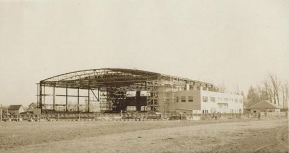
Another, slightly earlier, photograph of the building under construction is below. Compare the white, rectangular building at right foreground with the same building, above.
Hangar Under Construction, Rochester, NY Airport, Ca. Mid-Late 1930s (Source: Russell)
 |
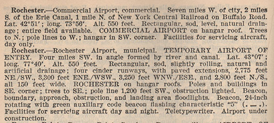
Below, from this 1937 REFERENCE, is a description of the Rochester Municipal Airport. By 1937 it was designated as a temporary customs airport of entry, probably due to Canadian traffic. An extra cinder runway and paved extensions were added. Note, too, that this description states explicitly, "Airport under construction."
Rochester, NY Airport, 1937 (Source: Webmaster)
 |
Below, from this 1938 REFERENCE, is an aerial photograph of the Rochester Municipal Airport.
Rochester, NY Airport, Circa 1938 (Source: Webmaster)
 |
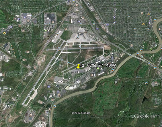
On Google Earth today, you can see the 1937 airport coordinates, 43° 07'N, 77° 40'W (at the map pin), lie on the Rochester International Airport ramp in front of the Rochester Flying Club building.
Rochester International Airport, December 12, 2013 (Source: Google Earth)
 |
---o0o---
THIS PAGE UPLOADED: 12/12/13 REVISED: 12/21/22
|