|
Baltimore had a fairly good-sized municipal airport during the time of the Davis-Monthan Airfield Register. Below, from this REFERENCE, page 99, is a photograph of Baltimore Municipal Airport (Logan Field) taken May 28, 1932. The manager of the field at this time was Louis M. Rawlins, Jr. (the only reference I can find for him is that he was involved in an accident, maybe two, as a member of a USAAF aircrew). The airfield was 7.5 miles southeast of Baltimore on 147 acres (rectangular).
Baltimore Municipal Airport (Logan Field), May 28, 1932 (Source: Webmaster)
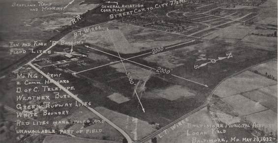 |
Two of its runways were black cinder and one was asphalt and cinder. It is easy to see the black cinder runways. The combo runway is 3,000' NW-SE. It had a revolving beacon in the southwest corner as indicated on the photograph, as well as flood lights and an illuminated wind cone. There was a Department of Commerce teletype on the field, as well as a telephone and weather reports.
"Modern" hotels were in the city with the taxi fare being $.75, or the bus running a 15-minute schedule. Fuel, oil, storage and repair facilities were on the field. There was no landing of flood light fee. Storage fees were $1.50 daily, with reductions for monthly stays.
A seaplane ramp and mooring was available to the northwest of the airport. There were also facilities for National Guard and military planes. Two pilots (both military, flying Douglas aircraft) identified Baltimore, MD as their home base. They were probably referring to Logan. No pilots arrived from there or cited Baltimore as their final destination.
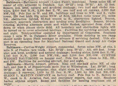
There were other airfields in the Baltimore area. Below, from this REFERENCE, page 83, are descriptions of three Baltimore airfields from 1937.
Baltimore Airfields Descriptions, Ca. 1937 (Source: Webmaster)
 |
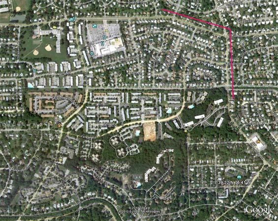
Below, a Google Earth image of the location specified by the lat/long coordinates in the description above for Logan Field. The coordinates fall within the area bounded by the red box that I have superimposed on the image. This location is corroborated by the description for Logan Field at the link. That description identifies it as the area bounded by Belclare Road, Dundalk Avenue, and Sollers Point Road. These are the yellowish lines inside the red box with Belclare at the north, Sollers Point on the east and Dundalk angling through the west and south. These thoroughfares can be seen in the 1933 image, above. The railroad depicted is still there also. Learn more at the link.
Baltimore Municipal Airport (Logan Field), 2010 (Source: Google Earth)
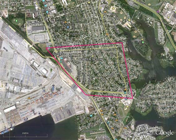 |
There is nothing identifiable as the old Logan Field. As far as the seaplane mooring a mile to the west, it is not identifiable either. The gray surface to the west of the old field is now what looks like a freight staging area with thousands of automobiles and vans parked in neat rows.
Below, a Google Earth image of the location specified by the lat/long coordinates (q.v.) in the description above for the Curtiss-Wright Airport. It began operations in 1929 and closed to civilian traffic during WWII. In 1946 it reopened to civilian traffic under the name Pimlico Airport. It closed for good ca. 1949.
Baltimore Curtiss-Wright Airport, 2011 (Source: Google Earth)
 |
Further information about the Curtiss-Wright/Pimlico facility is at the link. According to information at the link, the lat/long coordinates are in the far southeast corner of the airfield (q.v.), with the northeast corner being at the intersection of Smith and Greenspring Avenues. I have identified that intersection with red lines. Smith runs east and west. The area is all residential today.
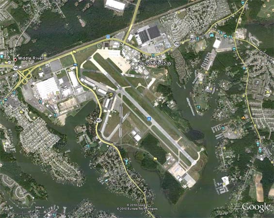
Below, a Google Earth image of the location specified by the lat/long coordinates (q.v.) in the description above for the private Martin Airport. The coordinates fall on the property of the contemporary Martin State Airport. The Glenn L. Martin Aviation Museum is housed at the airport.
Baltimore Martin State Airport, 2011 (Source: Google Earth)
 |
---o0o---
THIS PAGE UPLOADED: 01/04/11 REVISED: 04/24/18
|